Collaborative Wildlife Monitoring in Northwest Alberta
Categories: Wildlife Monitoring
Status: In Progress
About the Project
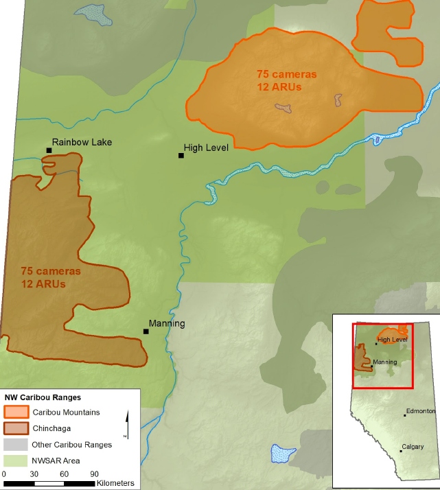
Data collection to support Woodland Caribou management has been identified as a priority by the NWSAR committee. NWSAR worked with the ABMI and the Alberta Trappers Association to deploy remote cameras and autonomous recordings units (ARUs) starting in winter 2019/20 to collect data on ungulates and predators in two Woodland Caribou ranges in northwestern Alberta. These units will provide information on trends in mammal densities across time and space in an area where little data exists otherwise.
- Alberta Trappers Association
Our Approach
Remote cameras and ARUs are currently the best approach for surveying the abundance of multiple mammals simultaneously. Their use allows for:
- Density estimation for species of interest
- Simultaneous data collection for all medium- to large-sized mammals
- Standardized protocols to allow for comparison with regional/provincial datasets
- Involvement of local hunters, trappers, and citizens in data collection
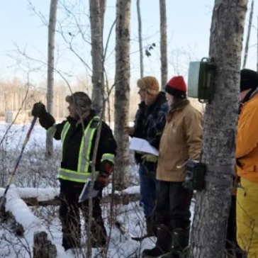
Members of the Alberta Trappers Association (ATA) deployed cameras and ARUs in five grids in the Caribou Mountains and Chinchaga caribou ranges in northwestern Alberta in the winter of 2019/20. By the end of March 2020, 150 cameras and 24 ARUs had been deployed by the ATA. Trappers have been servicing these devices annually in the winter ever since.
Project Impact
The resulting information will provide the most complete understanding yet of the status of species in two of Alberta’s northwest caribou ranges. Results will be shared publicly and will help inform decisions around land management, habitat restoration, and the responsible stewardship of species-at-risk, such as the Woodland Caribou. Perhaps as importantly, the project also shows the value of collaboration among scientists, municipal representatives, and community members.
The data collected from these cameras in addition to other similarly deployed cameras by the ABMI’s Caribou Monitoring Unit can help us answer questions such as:
- What are the relative impacts of human habitat alteration and natural habitat variability, including climate, on mammal populations?
- How does the mammal community respond to wolf reductions as a caribou recovery action?
- How does the mammal community respond to habitat restoration as a caribou recovery action?
- What drives the expansion of white-tailed deer—an invasive species to northern Canada—over space and time?
Led by Alberta Environment and Parks and the Grande Cache Trails Working Group, this project’s goal is to collect information on recreational use and wildlife in the Willmore Wilderness Park and nearby public lands.
This project monitors rare animals in Alberta’s Lower Athabasca region.
In this pilot project, we developed a dataset called HydroPatterns that maps open surface water dynamics over both space and time.
