Terrestrial Habitats
To map and monitor these habitats in “natural areas”—areas outside of visible human footprint—we combine diverse geospatial datasets and a variety of the latest tools and technologies.
The principal data sources include open access satellite imagery, terrain models, aerial photography, and laser scan data (i.e., lidar). The main tools and technologies include:
- GIS and image processing software,
- Cloud-based data archives and analysis platforms, and
- Machine learning such as decision trees, neural networks, and deep learning.
Terrestrial habitat mapping and monitoring is done within two units in our Geospatial Centre, based on scales of data and analysis: the Earth Observation Insights Unit is done within both the Geospatial and Imaging Centres, based on the scales of data and analysis.
- Within the Geospatial Centre, the Earth Observation Insights Unit uses open access satellite data, cloud computing, and machine learning to build large-scale maps of the changing environment.
- The Imaging Centre is focused on local-level maps leveraging high-resolution aerial imagery and lidar data.
Earth Observation Insights
Harnessing the power of satellite data to monitor our changing environment.
The Earth Observation Insights Unit brings together open access satellite imagery from multiple sources, including Sentinel-1 (microwave radar) and Sentinel-2 (multispectral optical), terrain datasets (e.g., digital elevation and surface models), and other geospatial information to map and monitor terrestrial habitats across Alberta.
This work leverages Google’s cloud-based Earth Engine platform alongside the latest machine learning techniques to tackle the challenges of large-scale land cover mapping. Much of the Earth Observation Insight's terrestrial mapping has focused on wetlands, but it also includes upland mapping.
To learn more about Earth Observation Insights Unit (formerly “ALPHA” or “Advanced Land cover Prediction and Habitat Assessment–Satellite”), check out this webinar from February of 2019, or go to our Open Data Portal to access various satellite-based products freely available for download.
Wetland Habitat Mapping and Monitoring
A Wetland Inventory for Alberta
The Google Earth Engine-powered webmap for visualizing this dataset is available here.
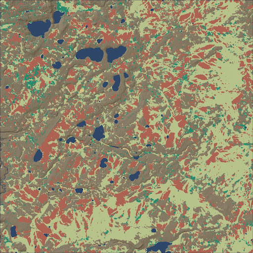
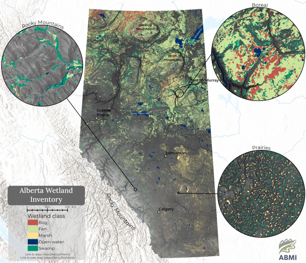
Our Alberta-wide Wetland Inventory, released in 2021, maps major wetland classes—fen, bog, marsh, swamp, and open water—following the mapping standards outlined in the Alberta Wetland Classification and Canadian Wetland Classification Systems. We mapped using Sentinel-1 and -2 satellite imagery, terrain datasets, and other inputs such as the Human Footprint Inventory. We leveraged Google’s cloud-based Earth Engine platform and machine learning technology (e.g., neural networks) to handle the large volumes of complex multi-source data needed for habitat mapping at these scales.
The province was divided into three broad ecoregions for wetland mapping, each with its own distinct wetland characteristics:
- the boreal and foothills regions with their large peatland complexes,
- the prairie region with its dynamic depressional potholes, and
- the Rocky Mountain region where mapped wetlands are constrained to narrow valleys.
Wetlands were mapped separately in each region using specially designed methods and then combined to form the Alberta-wide inventory.
Details on methods can be found in the technical documentation that accompanies the dataset in our Open Data Portal.
.png)
Map showing the ABMI’s Alberta-wide Wetland Inventory.
Upland Habitat Mapping
Work is in progress within the Geospatial Centre to develop upland habitat inventories for Alberta's boreal regions. This work will combine optical Sentinel-2 and radar Sentinel-1 satellite imagery from the European Space Agency with machine learning in Google’s Earth Engine environment. The ABMI’s 3 x 7 Photoplot and Human Footprint Inventory datasets, alongside other data sources, are key to helping classification algorithms learn to differentiate different upland classes.
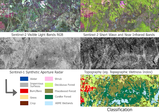
Figure showing potential mapping inputs and a preliminary upland classification in northern Alberta.
Explore our Geospatial Data
Explore, visualize, and create maps and data summaries for areas of interest in the province of Alberta.
Information on Vegetation Structure
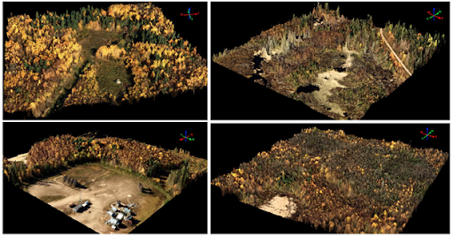
The Imaging Centre brings aerial photography, 3D lidar point clouds, and machine learning together to map and monitor fine-scale habitat features, bridging the scale gap between satellite imagery and ground observations. Mapping vegetation structure down to the individual tree level can offer valuable information on vegetation status, health, and trends. This in turn can help us understand the recovery of vegetation on seismic lines, or contribute to detailed wetland classification.
See the potential in the ABMI's publication on caribou habitat mapping in northwestern Alberta.