Human Footprint
The ABMI defines human footprint as the visible alteration or conversion of native ecosystems to temporary or permanent residential, recreational, agricultural, or industrial landscapes. The definition includes all areas under human use that have lost their natural cover for extended periods of time, such as cities, roads, agricultural fields, and surface mines. It also includes land that is periodically reset to earlier successional conditions by industrial activities such as forestry cutblocks and seismic lines. Some human land uses, such as grazing, hunting, and trapping, are not yet accounted for in our human footprint analyses.
Effective management of human footprint requires a reliable and credible system for monitoring and reporting. Since 2015, we have been collaborating with the Government of Alberta on the Alberta Human Footprint Monitoring Program (AHFMP) to improve the accuracy of human footprint mapping in the province.
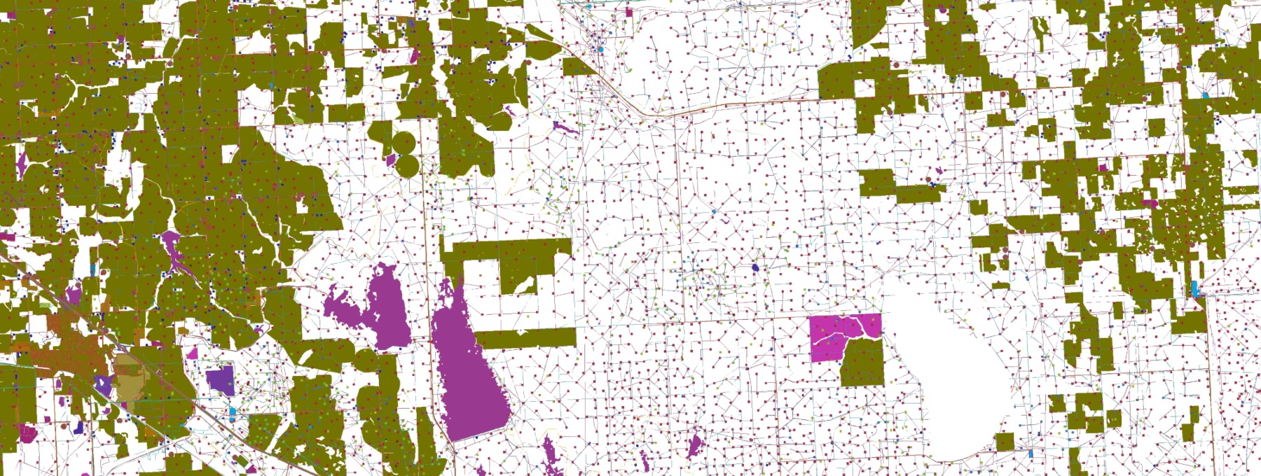
Together, we produce a comprehensive Human Footprint Inventory for the entirety of Alberta. This dataset dates back to 2000 and is now updated annually to reflect changing human footprint condition across Alberta. The current Human Footprint Inventory contains 112 feature types and 20 individual sublayers including seismic lines, harvest areas, roads, and pipelines.
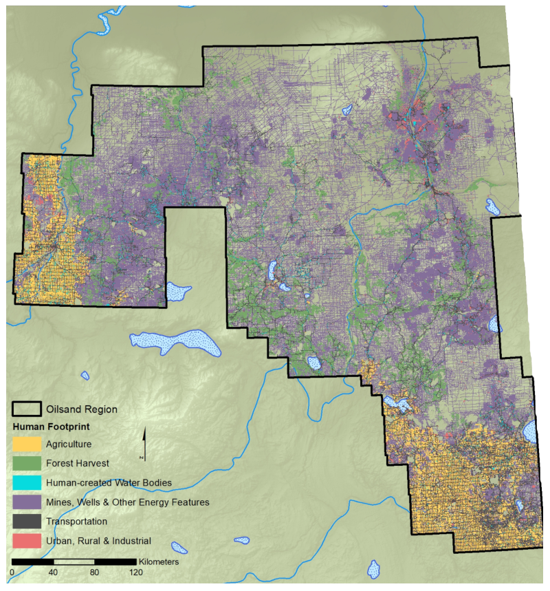
The human footprint team has also produced an enhanced human footprint inventory for the Oil Sands Region. This has all the same data as the province-wide inventory but with more detailed information such as age attribution, light pollution, and information on post-disturbance revegetation.
We define human footprint as the visible alteration or conversion of native ecosystems to temporary or permanent residential, recreational, agricultural, or industrial landscapes. The definition includes all areas under human use that have lost their natural cover for extended periods of time, such as cities, roads, agricultural fields, and surface mines.
Human footprint also includes land that is periodically reset to earlier successional conditions by industrial activities such as forest harvest areas and seismic lines.
Some human land uses, such as grazing, hunting, and trapping, or the effects of pollution, are not yet accounted for in our human footprint analyses.
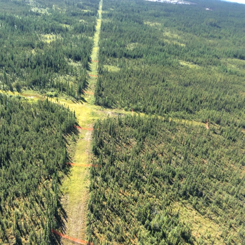
Photo: Seismic Lines (Photo: Rob Serrouya)
Read about the status and trend of human footprint across Alberta in our online report. Hone in on specific areas, such as provincial land-use planning regions.
The Human Footprint Inventory maps 117 types of human footprint at a provincial scale. These are available individually or compiled into seven different feature layers, including"Agriculture", "Transportation", and "Forest Harvest". Browse the layers on our interactive Mapping Portal or dive into using them for your own analyses through our Open Data Portal.