_Oil%20drill%20in%20winter-banner-1.jpg)
Oil Sands Monitoring
Alberta's Oil Sands Region
The Oil Sands Region of Alberta is an area approximately 140,000 km2 in size and sees many human land-use types, including surface and in-situ oil sands mining.
Since 2003 we have monitored over 600 locations in both terrestrial and wetland environments, and from 2003 to 2019 we focused on completing the first inventory of Ecosystem Health Program sites in order to understand regional cumulative effects on biodiversity in the region. Since 2020 we have focused on monitoring under the Before-After-Dose-Response (BADR) program for terrestrial biology, which targets oil-sands specific features to assess their impacts on wildlife.
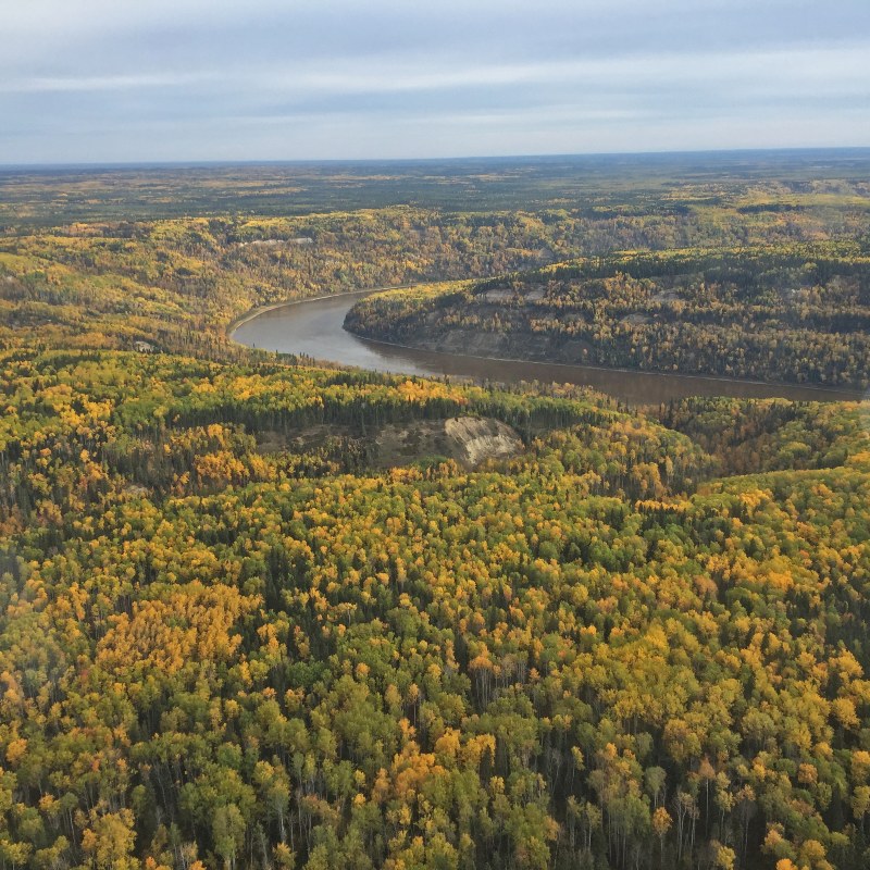
Aerial view of Athabasca River
Today, environmental monitoring in the Oil Sands Region is coordinated by the Oil Sands Monitoring (OSM) program. OSM comprises a range of ambient environmental monitoring programs across a variety of environmental contexts, including air, water, and land. Since 2018 the ABMI has delivered part of environmental monitoring within the program’s Terrestrial Biological Monitoring theme.
In 2019, in collaboration with the other members of OSM’s Terrestrial Biological Monitoring science team and OSM’s Terrestrial Technical Advisory Committee, we participated in developing the integrated Before-After-Dose-Response—or BADR—monitoring design for the Oil Sands Region. BADR is a multi-scale, stressor-based monitoring design to adaptively target oil sands industrial activities and increase our understanding of how species and communities are changing in response to specific oil sands stressors. Our current monitoring efforts under OSM are focused on implementing the BADR program.
For more information, see the BADR technical report.
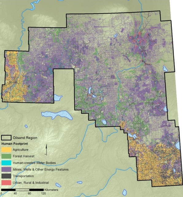
We also monitor natural and anthropogenic landscapes within the Oil Sands Region through our geospatial programs. We have developed high-resolution maps of physical disturbance in the oil sands annually since 2014 and are working on producing historical datasets. Since 2018 we have also produced an annual enhanced human footprint product including information about light, noise, and vegetation (among others) on disturbances. These products provide information on how the amount and distribution of disturbance is changing within the region, and when combined with data from EHP and BADR programs, allow us to understand how wildlife and habitats are changing in response to oil sands stressors.
For more information, see the online report on Status of Human Footprint in the Oil Sands Region.
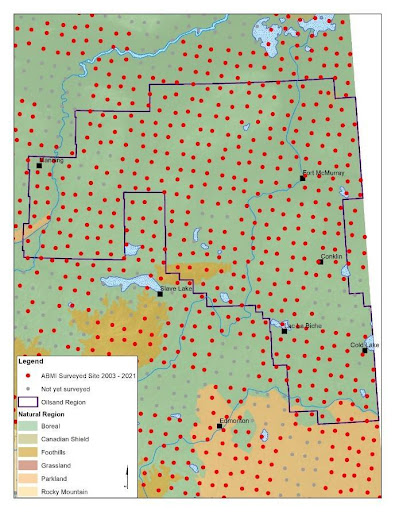
The ABMI completed a baseline inventory of biodiversity as part of our Ecosystem Health Program within the Oil Sands Region from 2003–19. We visited over 600 monitoring locations in terrestrial and wetland environments to understand biodiversity status.
Please visit our partners’ websites for more information on our collaborators on the Before-After-Dose Response program design.
- Oil Sands Regional Summary
- BADR Technical Report
- ABMI’s oil sands data can be found in the Open Data Portal and WildTrax.
- The Oil Sands Monitoring Program operates a Data Catalogue that compiles data from across the program, including data from other environmental contexts such as water and air.
- Terrestrial Synthesis Paper – A synthetic review of terrestrial biological research from the Alberta Oil Sands Region: 10 years of published literature.
