Hydrological Habitats
Hydrological features across Alberta change continually and require regular mapping. The Geospatial Centre’s Earth Observation Insights Unit uses regular, repeating satellite image streams alongside other geospatial data, such as terrain, to capture aspects of the province’s dynamic hydrological habitats. Combining province-wide imagery from multiple years and seasons enables us to map changing surface water extents, while including terrain can help us pinpoint depressions and areas likely to flood.
We have three key areas of work on hydrological habitats:
- Algal Bloom Monitoring
- Open Surface Water Mapping
- Groundwater Dependent Ecosystem Mapping
Each focuses on changes to surface water features and relies on geospatial inputs from multiple dates, as well as cloud computing and machine learning technology. For information on our wetland mapping work, please check out our Terrestrial Habitats page.
The effective and timely monitoring of harmful algal blooms in Alberta lakes is important for managing freshwater quality, aquatic ecosystem health, and potential risks to human and wildlife health.
We are collaborating with the University of Alberta, the Alberta Lake Management Society, Alberta Environment and Protected Areas, and several other organizations to develop methods for the near-real time mapping of algal blooms. Work has focused on the satellite remote sensing of cyanobacteria pigments in particular lakes, identifying the right combination of wavelength reflectances in optical satellite imagery, and linking these to surface water samples. Imagery from both Sentinel-2 and Landsat are being leveraged. The former offers higher spatial detail, while the latter offers insights into historical trends.
This collaboration is ongoing; a detailed description of the work can be found on the Algal Bloom Monitoring Project page.
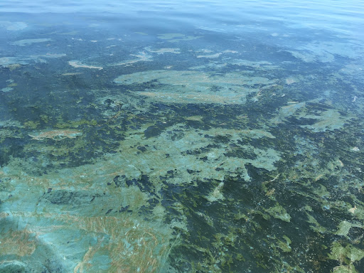
Cyanobacteria algal bloom in Pigeon Lake, summer 2020. Photo: Alberta Lake Management Society.
.jpg)
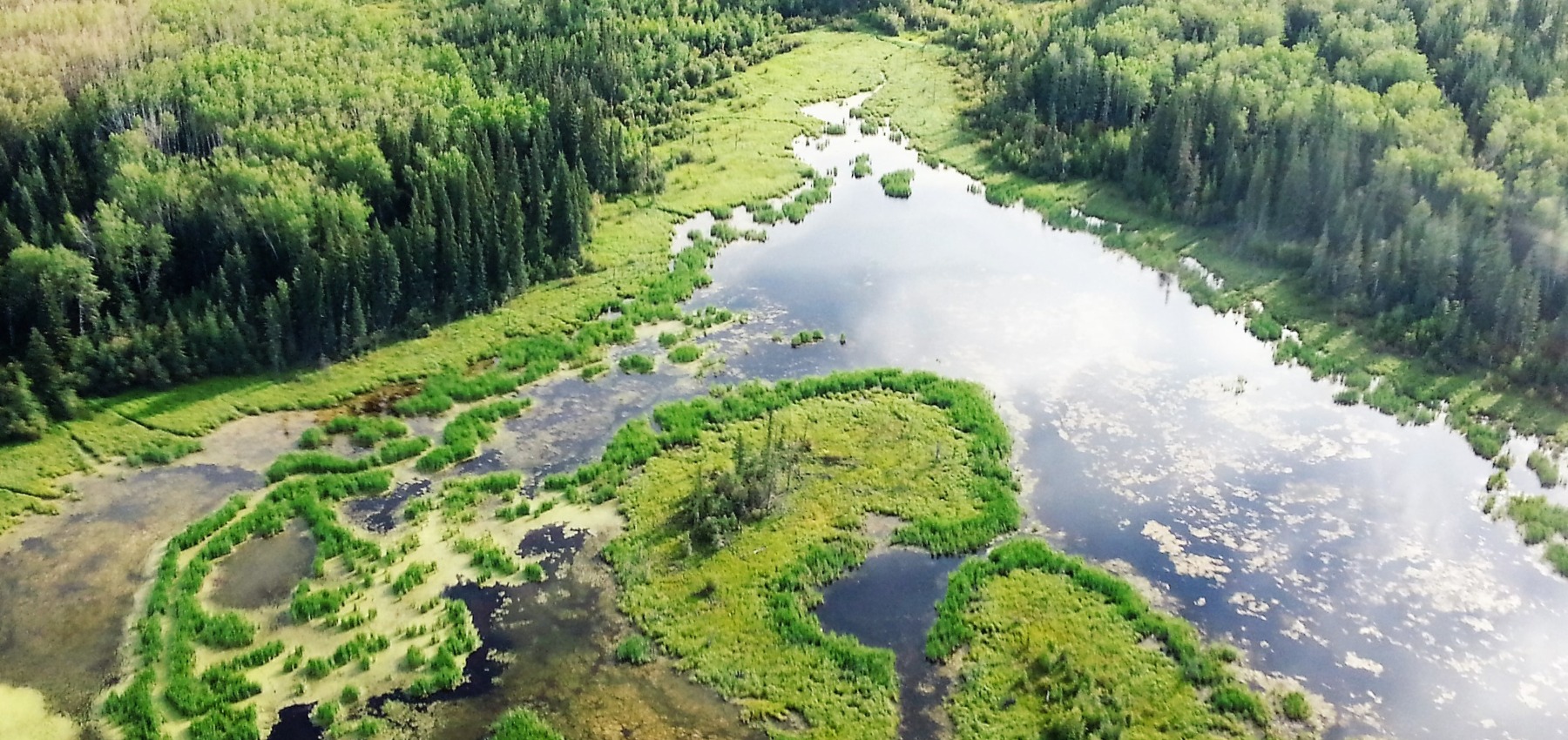
Beaver pond. Photo: Jenet Dooley
Open surface water in lentic ecosystems - including lakes, reservoirs, ponds, dugouts, and wetlands - is dynamic, with its extent varying daily, monthly, seasonally, and annually. These water features offer key ecosystem services, such as habitats for amphibians and migratory birds, flood and drought regulation, natural water filtration, and connections between surficial water and aquifers. Monitoring these changes is important for effective water and habitat conservation, water management, land-use planning, biodiversity monitoring, and climate change mitigation.
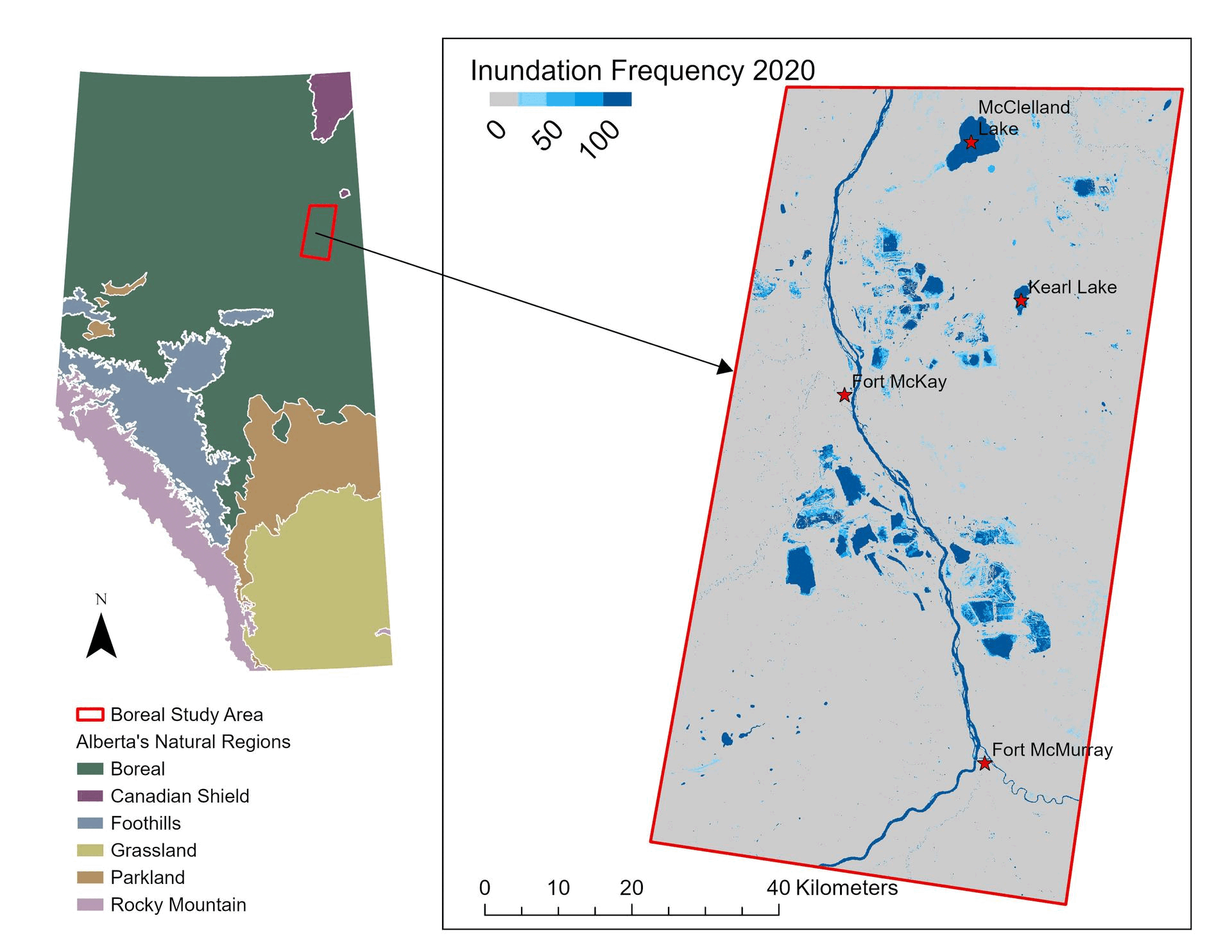
Annual innundation frequency (boreal). Click map to zoom.
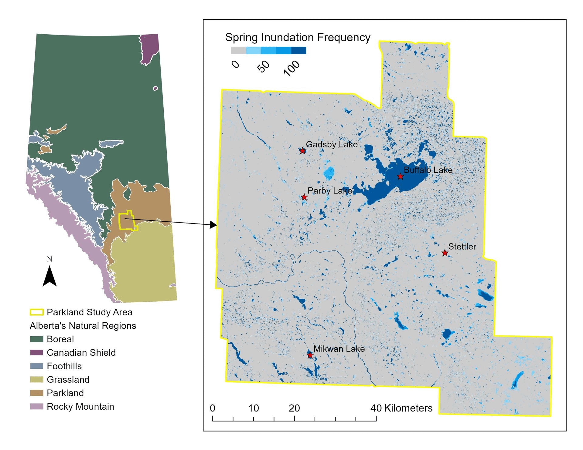
Seasonal inundation frequency (prairie). Click map to zoom.
In 2025, building on the success of earlier Hydro-Temporal Variability work described in the next section, the Geospatial Center developed the HydroPatterns dataset using a fully-automated workflow for mapping open surface water fluctuations over time. HydroPatterns maps monthly open surface water presence at a 10 m spatial resolution across the 2020-2023 growing seasons (May to October). The analysis primarily relied on the European Space Agency’s Sentinel-2 optical imagery, supplemented by Sentinel-1 radar imagery in cloud and shadow areas, along with topographic variables from a satellite-based terrain dataset. Machine learning algorithms were leveraged, and the workflow was tested in two study areas in Alberta: one in the boreal region and one in the prairies.
The HydroPatterns dataset maps open surface water with an overall accuracy above 90% with enhanced edge delineation of water features. Compared to the Hydro-Temporal Variability dataset, HydroPatterns detects more non-permanent water features and reduces classification errors.
We are now exploring opportunities to expand HydroPatterns into provincial-scale dataset.
The HydroPatterns dataset is available through our Open Data Portal. Additional details about this product and its development can be found in the accompanying report and the recorded webinar.
Early work on mapping open surface water dynamics in the Geospatial Centre produced the Hydro-Temporal Variability dataset for the entire province, published in 2017. Using the European Space Agency’s Sentinel-1 radar satellite data, images from the 2014-2017 growing seasons were compiled to summarize variation of surface water across the province over time. The resulting Hydro-Temporal Variability layer shows the percentage of time that a particular location (e.g., a 10 m pixel) was classified as “water” during the represented time period. Values range from 0% for areas with no open water to 100% for permanent water bodies. These data provide an estimate of water permanence and variability in Alberta over this time period.
The Hydro-Temporal Variability dataset is available through our Open Data Portal. More details about this product and its creation can be found in the accompanying technical documentation and publication.
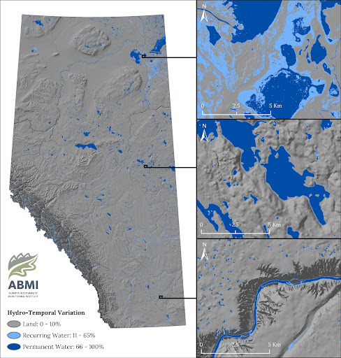
Hydro-temporal variation map for Alberta.
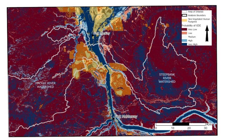
Map showing the modelled probability of aquatic groundwater dependent ecosystems over the MacKay and Steepbank River Watersheds in northeastern Alberta.
Ecosystems maintained by direct or indirect access to groundwater and relying on water flow or groundwater chemical characteristics for some or all of their water requirements, are called groundwater dependent ecosystems (GDEs). They are found in aquatic, terrestrial, and subterranean environments, and can include lakes, rivers, wetlands, springs, riparian habitats, and aquifers. As important biodiversity hotspots, GDEs support a wide range of vegetation and wildlife, and are an important cultural resource for Indigenous communities. They are also critical components of local hydrological systems, playing a critical role in local water resource management. Understanding GDE full distribution and extent across Alberta remains a major knowledge gap, however.
Members of the ABMI’s Geospatial Centre have been collaborating closely with InnoTech Alberta to develop novel, artificial intelligence-based workflows for mapping GDEs within Alberta. By bringing together a variety of geologic, topographic, wetland and remote sensing-based inputs alongside machine learning models, the team produced maps of aquatic GDEs across a portion of the Alberta Oil Sands (see our Mapping Groundwater Dependent Ecosystems in Alberta's Oil Sands Region report for more details). Maps revealed new information about GDE distribution across the area of interest, showing the importance of fens, rivers, and streams as local GDEs, reflecting patterns of groundwater contributions in both the Mackay and Steepbank River watersheds. GDEs in these watersheds are particularly vulnerable to resource development activities occurring within Alberta’s Oil Sands Region, as illustrated by this Canadian Conservation and Land Management infographic.
See this ABMI blog post on GDE mapping for more information about this ongoing work.
