Accuracy Assessment of the Alberta Wall to Wall Landcover Polygon Vector Layer circa 2000, Beta Version (ABw2wLCV2000beta)
Published: May 31, 2012
Author(s):
Castilla G, Brichieri-Colombi T, Cuervo V, Iwamoto R, Rasheva D, Hernando A, Zhang C, Mazumdar D, McDermid GJ
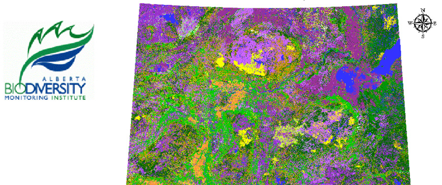
Description: This document provides background, methods, and results for the accuracy assessment of the Alberta wall to wall landcover polygon vector layer, circa 2000, beta version. The latter is a map describing the spatial distribution of landcover classes across the province of Alberta at a cartographic scale of 1:125,000 and for the reference year 2000. This document also suggests legend and production changes for the final version of this landcover map.
Document Type:
Biodiversity Research and Science Development - Geospatial Research
Subject Area:
Mapping,
Program Development,
Remote Sensing
Citation:
Alberta Biodiversity Monitoring Institute. 2012.
Accuracy Assessment of the Alberta Wall to Wall Landcover Polygon Vector Layer circa 2000, Beta Version (ABw2wLCV2000beta).
Available at: https://abmi.ca/publication/82.html
Share this publication