News & Events

ABMI Releases Status of Biodiversity Reports on the Upper Peace and Lower Peace Regions of Alberta

POSTED ON:

Today, the ABMI releases its latest reports, first-of-its-kind analyses of the current condition of biodiversity and human footprint in the Upper Peace Region (UPR) and Lower Peace Region (LPR) of Alberta.

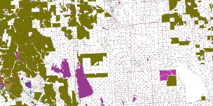
The extent of human footprint varies considerably between these land-use planning regions: as of 2010, it measured at 32.1% and 7.3% for the Upper Peace and Lower Peace Regions, respectively. In the UPR, the dominant activity on the landscape is agriculture, which covers 20.3% of the region and is almost three times larger than the next largest footprint category, forestry, at 7.9%. By contrast, forestry is the largest human footprint type in the LPR, but covers only 2.8% of the region, followed closely by agriculture at 2.5% and energy at 1.6%.

In terms of trend, however, the largest increase in footprint between 1999 and 2012 for both regions was driven by forestry; an additional 3.5% and 1.3% of the UPR and LPR was covered by forestry during this period, respectively. As a result of this upward trend, forestry surpassed agriculture as the dominant footprint in the LPR over this time frame.

Each of the ABMI reports also evaluates the current condition of several hundred species of plants and animals (396 species for the UPR report, and 420 for the LPR report) to determine the overall Biodiversity Intactness—a measure of how much more or less common a species is compared to an undeveloped landscape free of human footprint. Reflecting the difference in human footprint between each region, Biodiversity Intactness stands at 81% in the UPR and 94% in the LPR.

Common to both regions, the biggest ecological changes are associated with the higher-than-expected abundance of human-associated species, such as Coyote and Red Fescue, a species of grass among the first to colonize recently disturbed areas. Furthermore, species that prefer old forest habitat, like the Black-throated Green Warbler (an Alberta Species of Special Concern) and Fisher (a small carnivorous mammal that’s a member of weasel family) were found to be less abundant than expected.

In the UPR, several plants species associated with prairie habitats—such as June Grass, Western Wheat Grass, and Harebell—were also shown to be less abundant than expected with increasing agriculture. Furthermore, 50 non-native weeds, including the noxious Creeping Thistle, were detected in the region; where found, an average of 5.2 

non-native weed species was present. By contrast, 37 non-native weeds were detected in the LPR, with an average of only 2.8 species present at positive locations.

Each report also highlights a specific sub-region of interest. The White Area, or agricultural region, is highlighted for the UPR. As of 2010, the total human footprint was 63.4%, with agricultural coverage at 56.4%. Based on an assessment of 396 species in the White Area, the average Intactness is 50%, which is 31% lower than the overall regional value.

For the LPR, results from the Peace River Oil Sands Area (PROSA) are highlighted. Agriculture footprint was the dominant footprint type in the PROSA at 12.1%, followed by forestry at 3.3% and energy at 2.3%. An assessment of the status of 415 species in the PROSA found them to be, on average, 85% intact—about 10% lower than the LPR as a whole.

“As the Government of Alberta proceeds with developing biodiversity indicators and thresholds for various regional land use plans, it’s precisely this type of unbiased, evidence-based information that should inform the deliberations,” said ABMI Executive Director Kirk Andries. “This report serves as an ecological baseline from which we can measure change over time. It is a powerful tool for evaluating land use planning outcomes related to biodiversity in this region.”

Access the reports here:

[1] The ABMI defines “human footprint” as the visible conversion of native ecosystems to temporary or permanent residential, recreational, agricultural, or industrial landscapes.

[2] The reports are titled “The Status of Biodiversity of the Upper Peace Region” and the “The Status of Biodiversity in the Lower Peace Region”     

Recent News & Latest Events

Alberta Biodiversity Monitoring Institute Logo, Small

Alberta Biodiversity Monitoring Institute ©2014  All Rights Reserved     |  Privacy Policy |  Terms of Use |  Our Photos |  Glossary