Status of Land Cover and Biodiversity in Norbord Inc.'s Operating Areas
August 22, 2022
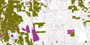
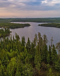
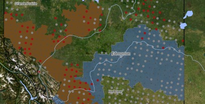
This online report describes the status of human footprint, species, and habitat in Norbord Inc.'s two main operating areas located in northwestern Alberta. This information establishes baseline conditions for several indicators of land cover and biodiversity which can be used to measure long-term forest health.
READ MOREHarvest Area Spectral Regeneration
January 6, 2021
The ABMI Harvest Area Spectral Regeneration 2018 product is a polygon data set comprising the ABMI’s Human Footprint Inventory (HFI) 2018 harvest area polygons, attributed with additional information on regeneration as detected through satellite-based spectral signals, where suitable. This data set is unique, complementing and enhancing current information on human footprint across Alberta by providing a broad-scale perspective on regeneration patterns.
READ MORESouthern Wetland Inventory
December 20, 2020
The ABMI Southern Wetland Inventory is a polygon-based data set with spatially explicit information of wetland extents based on 2020 satellite imagery. This data set covers nearly all of the Grassland and Parkland Natural Regions of Alberta and is 90% accurate. This product represents the most up to date wetland data set created by the ABMI for Alberta/Canada and can provide users with high quality data to meet their needs.
READ MORENew Report: Status of Land Cover & Biodiversity in the Alberta-Pacific Forest Industries Inc. Forest Management Agreement Area
June 23, 2020
This report describes the status of human footprint, species, and habitat in the Alberta-Pacific Forest Industries Inc. Forest Management Agreement area located in northeastern Alberta. This the third status report completed by the ABMI for this management area. The report can be viewed here.
Amphibians & Species Occurrence Maps
February 11, 2020
Amphibians species occurrence maps now available for species that vocalize during the breeding season. Occurrence information is based on data collected using automated recording units (ARUs) and can be viewed here.
Vascular plant species with wetland occurrence information can be identified using a wetland filter option on the vascular plant species search page.
Stay tuned...
We are working on adding species habitat association information for amphibians over the next few months along with habitat associations for mammals based on camera trap data.
Species-level Data Now Includes 2017 Data
September 22, 2019
ABMI's species profiles found in the Biodiversity Browser has been updated to include 2017 data, including updates to: species occurrence maps, habitat association graphs, sector effects, and predicted relative abundance maps. Two additions to species profiles are:
- new presentation of results showing the impacts of human footprint on species—or the sector analysis—which shows:
1) under footprint effects i.e. how a species relative abundance is predicted to change in each sector's footprint compared to the habitat it replaces, and
2) regional effects i.e. predicted change in total relative abundance across the region due to each sector's footprint. - wetland status indicators for those vascular plants species that are associated with wetlands, including occurrence data collected using our wetland protocols.
Species modeling results can be found in the Data Download section of the website under the category "Species-level Data Sets".
Remote Camera Mammal Data Online
April 8, 2019
The ABMI monitors mid- to large-sized mammals using remote cameras deployed at terrestrial and wetland sites across Alberta. These data are used to measure habitat use, distribution, and current status of mammals, as well as monitor changes in mammal populations regionally and provincially over time. Access this data here.
2016 Human Footprint Inventory Data
June 22, 2018
The Human Footprint Inventory data and metadata for 2016 has been posted to the Data & Analytics Portal.
3 x 7-km Photoplot Land Cover Data Update
May 15, 2018
3 x 7-km Photoplot Land Cover Data has been updated. Over 800 out of 1,656 photoplot sites have been completed as of May 2018.
The Boreal Surface Water Inventory
February 6, 2018
The Boreal Surface Water Inventory is a data set which gives the location, extent, and attributes of 421,348 waterbodies across the Alberta Boreal Forest Natural Region.
READ MOREBoreal Fen Probability
February 6, 2018
The Boreal Fen Probability Data Set is a raster based product which describes the probability of fen habitat at a 10m resolution across the entire Alberta Boreal Forest Natural Region.
READ MOREBoreal Wetland Probability Data
January 23, 2018
The Boreal Wetland probability data set is a raster based product which describes the probability of wetland habitat at a 10m resolution across Alberta's Boreal Forest Natural Region.
READ MOREData & Analytics Portal Updates
June 1, 2017
Newly-added Data
Mapping Portal - Ecosystem Services Layer:
- Rangeland
- Carbon Storage
Recent Data-related Publications
- Use of Unmanned Aerial Vehicles for Monitoring Recovery of Forest Vegetation on Petroleum Well Sites (Peer-reviewed)
- Terrestrial Field Data Collection Protocols (Abridged Version)
- Wetland Field Data Collection Protocols (Abridged Version)
Wall-to-Wall Human Footprint Inventory 2014 Version 2 Released
May 3, 2017
Wall-to-Wall Human Footprint Inventory 2014 Version 2 Released
READ MOREABMI Data & Analytics Portal Launched
March 28, 2017
Welcome to the ABMI’s Data & Analytics Portal—the source for ABMI data sets, derived data products, and mapping information collected for Alberta. Access our most recent datasets for species and habitat, get detailed mapping information, create customized biodiversity reports, and more. It’s all here!
ABMI Data Coming This Year
March 31, 2017
- 2014 Wall-to-wall human footprint v.2 - April 10, 2017
- 2016 wetland/terrestrial field-collected habitat data (trees & snags, downed woody material, etc.) - June, 2017
- Remote camera data - June, 2017
- 2016 wetland/terrestrial species data (vascular plants, soil arthropods, aquatic inverts, breeding birds etc.) - Oct. 31, 2017
Mapping Portal Launch
March 28, 2017
The ABMI's Data & Analytics Portal has a new and important addition. Our new mapping portal offers more ways to interact with and explore the ABMI's biodiversity data.
READ MORETerrestrial & Wetland Field Data
March 27, 2017
The updated versions (2017-03-27) of the ABMI’s Terrestrial and Wetland Field Data Collection Protocols have been posted to the publications page.
ABMI's Updated Species Website Manual
March 23, 2017
The updated version of the ABMI’s Species Website Manual has been posted to the publications page.