Mapping Portal
Explore, Visualize and Create
Who is the ABMI Mapping Portal for?
The ABMI Mapping portal is for anyone interested in geospatial data for the province of Alberta. This can include, but not limited to, First Nations and Metis communities, scientists, industry, government, non-profit organizations, and the general public.
What are the benefits of the Mapping Portal?
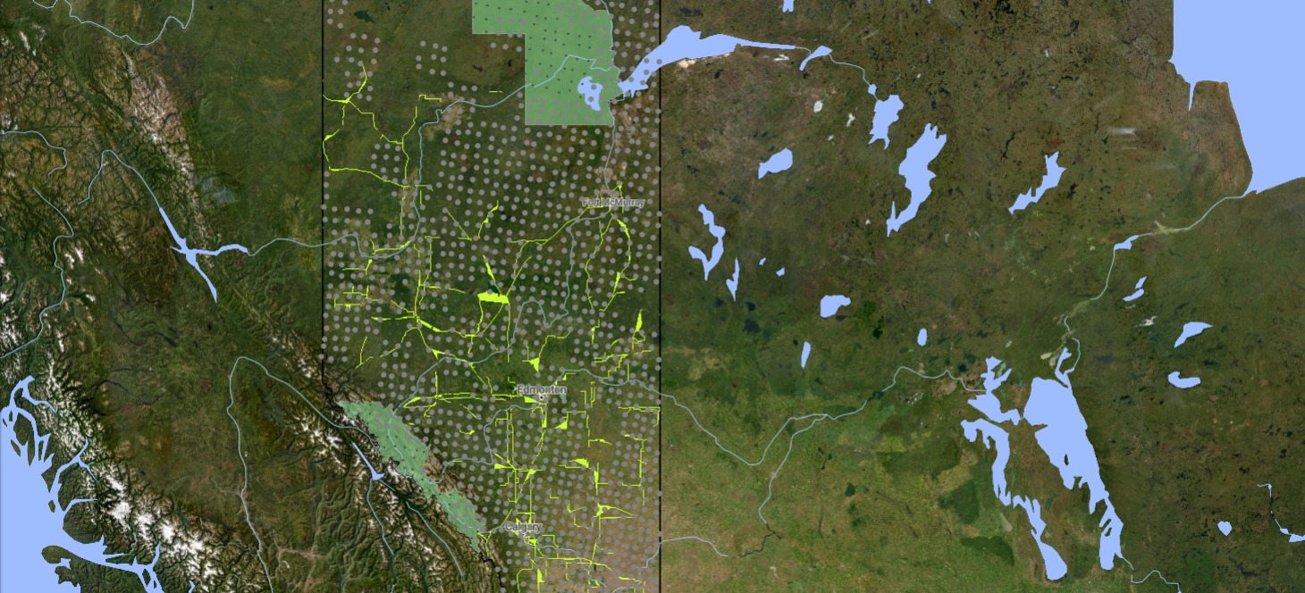
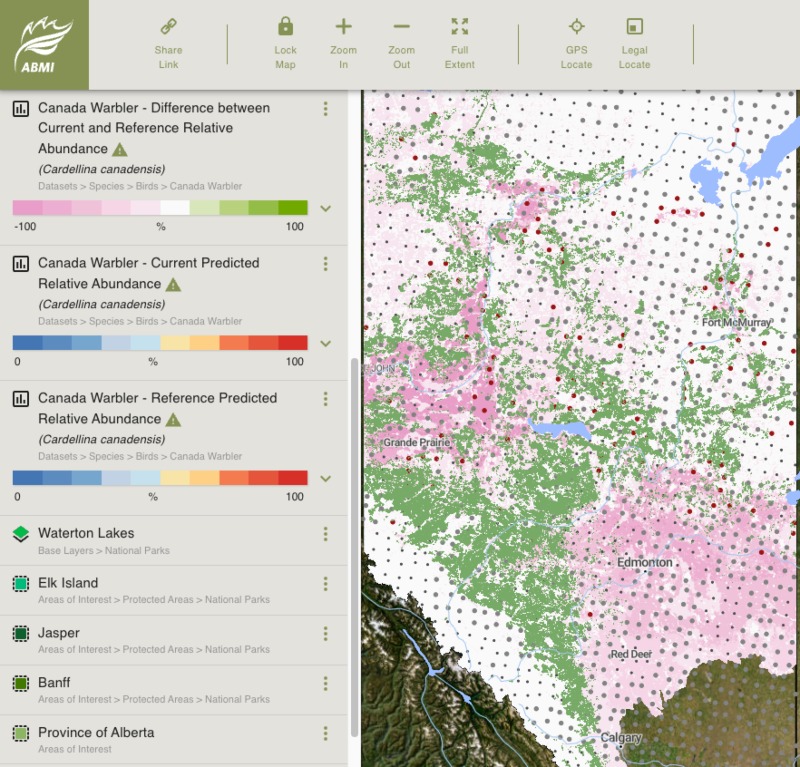
The Mapping Portal is free to use and accessible from anywhere with an Internet connection. Users don’t need any particular software or technical knowledge to explore and find mapping data that interests them. In fact, the technology behind the Mapping Portal allows users to easily view datasets that include millions of polygons. It’s up to users to decide what’s included! Whether it’s a map of human footprint or suitable habitat for Canada Warbler, users can select the datasets they’re interested in.
It’s a one-stop shop to explore the ABMI’s numerous datasets such as the Human Footprint or Wetland Inventories.
The Area of Interest layers let users focus on a particular region of the province. Users can also enter legal land descriptions or GPS coordinates to zoom into specific locations. Depending on the dataset, Some datasets such as the Human Footprint Inventory allow users to view simple data summaries for their Area-of-Interest in the main Layers pane. You can easily share a URL to your custom map; all the recipient will need is an Internet connection to see your map and explore the datasets available themselves.
There are many options to choose from when creating your custom map.
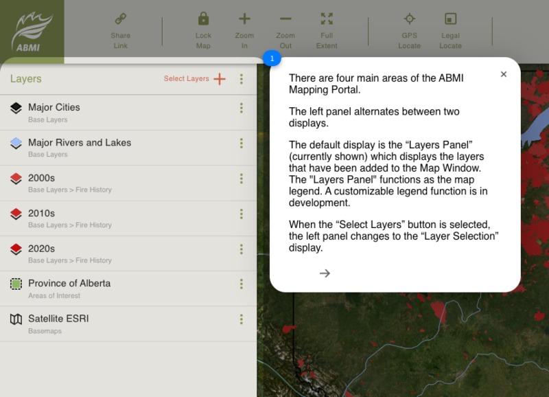
The menu of the Mapping Portal is organized hierarchically into four main folders—Datasets; Areas of Interest; Base Layers, and Base Maps.
Datasets
- Land Surface Data including the ABMI Human Footprint Inventory, the ABMI Alberta Wetland Inventory, and interior native habitat.
- Species Data including habitat suitability and occurrence information for taxa the ABMI monitors amphibians, birds, bryophytes, lichens, mammals, soil mites and vascular plants.
- Species at Risk including (if available) range maps, occurrences, and maps of habitat.
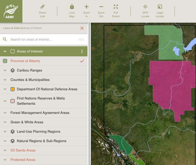
Areas of Interest
Including (but not limited to):
- Caribou Ranges
- Counties and Municipalities
- Forest Management Agreement Areas
- Green and White Areas
- Hydrologic Unit Codes
- Land-Use Planning Regions
- National Regions and Sub-Regions
- Oil Sands Areas
- Protected Areas
- Wildlife Management Units
- WPAC Regions
Base Layers and Base Maps
Base Layers
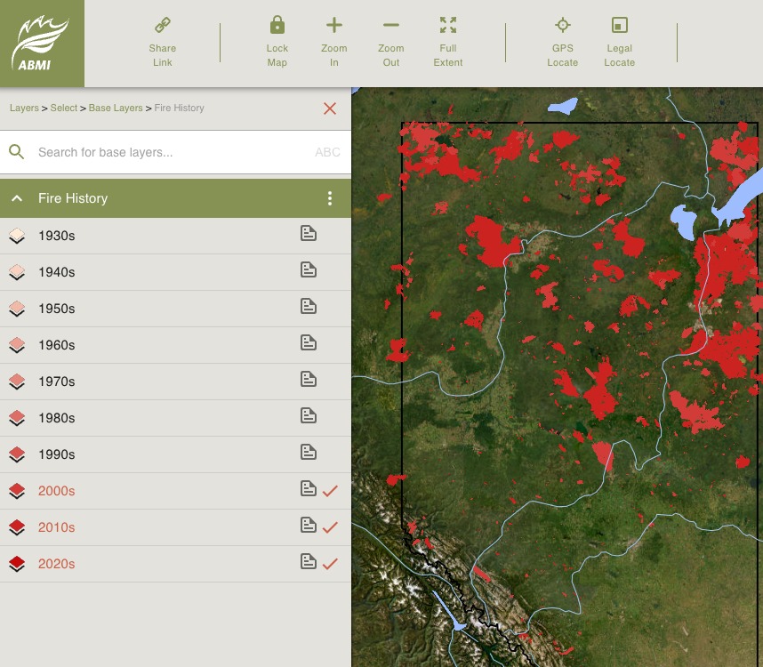
- Fire History (1930s-2020s)
- Major Cities
- Major Rivers and Lakes
- Protected Areas
- Department of National Defence Areas
- First Nations Reserves and Métis Settlements
- ABMI Sites
- Townships
Base Maps
- Topographic
- Grayscale
- Satellite ESRI
How do I use the ABMI Mapping Portal?
- Simply go to the ABMI Mapping Portal page.
- For new users, there is the option to “Take a Tour” to become familiar with the site.
- Begin by selecting the datasets, area of interest, base layers, and base map to create a custom map.
- Use "My Layers" to create an area of interest using the Alberta Township Survey land description.
- "Recently Selected Layers" allows you to quickly return to layers you previously viewed.
- There are options to change the display order of your layers, their opacity, and other characteristics to make a map that suits your needs.
- Zoom in and out of the map to see different resolutions and levels of detail.
- Open the side menu for layers to view metadata and data summaries (available for certain datasets) for your areas of interest.
- Use the ABMI Mapping Portal to share links to your customized map.
Explore our Geospatial Data
Explore, visualize, and create maps and data summaries for areas of interest in the province of Alberta.