Lidar data products are available from specific areas of interest where the ABMI has collected lidar data. These products are derived from high-resolution lidar data collected through aerial surveys.

Subject Area: Lidar
Update Frequency: As needed

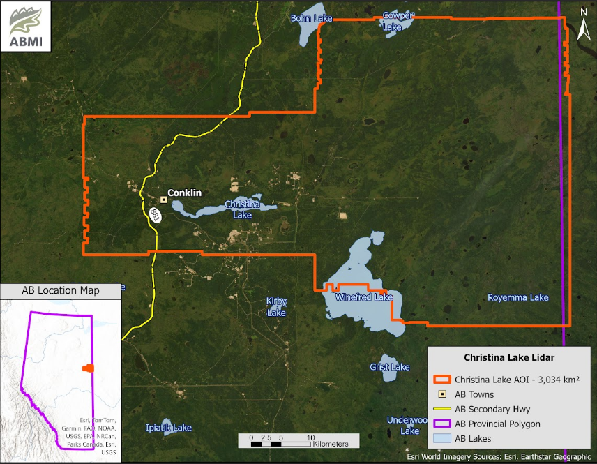
The location and boundary of the Christina Lake area of interest are shown on the map below for context.


TAKE OUR LIDAR DERIVATIVE DATA DOWNLOAD SURVEY

Lidar data represents a new addition to the ABMI’s data products, and your feedback is essential to help us improve. We hope to develop a better understanding of who is using the ABMI’s lidar data and for what applications. Please take a few moments to complete this brief survey when you download the data. Your insights are greatly appreciated!
 

--> TAKE OUR SURVEY
 

Dataset Information

Last Modified Date: Jun 1, 2024

Data provided by: ABMI Imaging Centre

Contact: abmidata@ualberta.ca

Citation: Alberta Biodiversity Monitoring Institute. Last modified Jun 1, 2024. (https://abmi.ca/data-portal/70).html

Share this dataset