Ecosystem Health and Oil Sands Monitoring Programs
ABMI field crews are assigned to work in one of our two main data collection programs. Each program requires different monitoring protocols depending on time of year, location, and whether the field site has been sampled before.
The ABMI is dynamic; something new is always in the mix. The following programs are how we work to monitor biodiversity across the province. As the ABMI continues to develop novel biodiversity monitoring protocols and programs, alternative tasks may be assigned to crews that must adapt to their assigned work. Our two main biodiversity data collection programs are detailed below:
Our Ecosystem Health Monitoring Program collects data at 1,656 randomly selected sites spaced every 20 km across the entire province. These include remote boreal forests, alpine meadows, and agricultural fields. A subset of sites are visited each year, with field technologists collecting data on terrestrial and wetland biodiversity on public, private, industrial, and protected land.
Spring protocols are completed at all terrestrial sites in May and June. Spring protocols include:
- Soil core collection for mite and soil chemistry analysis,
- Bryophyte and lichen collection,
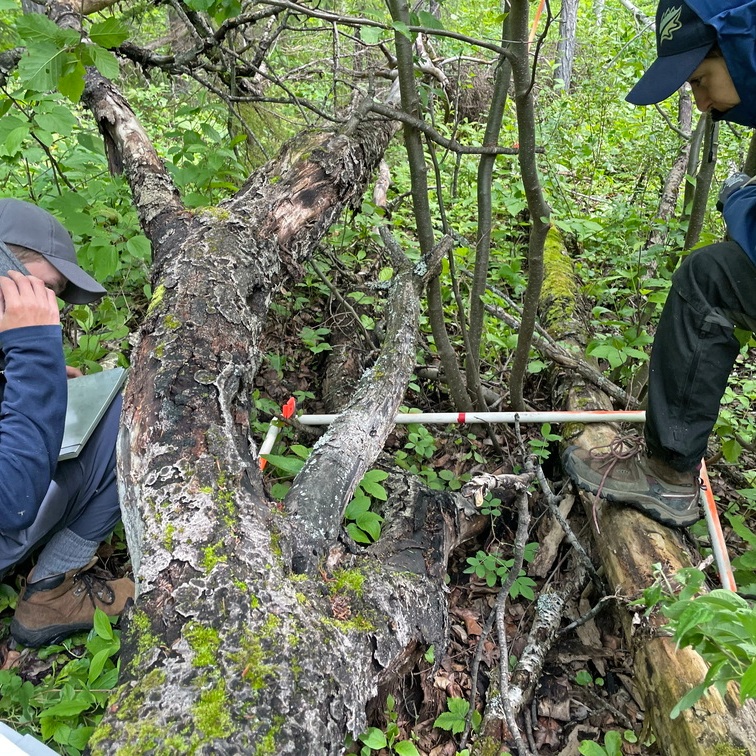
- Downed woody material measurement, and
- Forest stand measurements of species, height, and diameter.
In July, crews are split into terrestrial and aquatic crews. Terrestrial crews revisit spring sites while aquatic crews visit wetlands.
Terrestrial crews collect a variety of additional data during summer site visits. (Note that “terrestrial site” does not necessarily mean “dry site”!) Terrestrial summer protocols include:
- Vascular plant surveys,
- Tree core collection and canopy cover measurements,
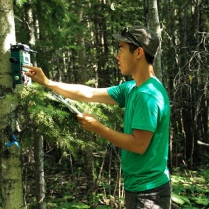
- Trail camera/autonomous recording units (ARUs), deployment/collection, and
- Ecosite classification.
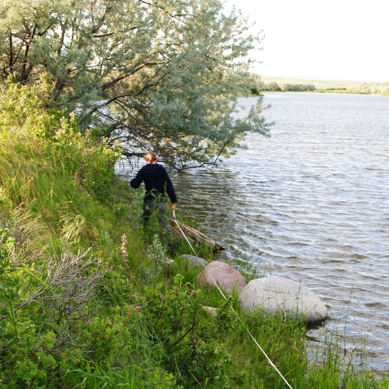
Aquatic crews visit wetlands across the province conducting a variety of wetland-specific protocols, several of which are done by inflatable kayak. These protocols include:
- Vascular plant surveys,
- Water physio-chemistry analysis,
- Aquatic invertebrate collection,
- Wetland zone mapping, and
- Bathymetric mapping.
The ABMI plays a significant role in the Oil Sands Terrestrial Biodiversity Monitoring Program, where we work with partner organizations to complete field work across the Oil Sands Region (OSR) in northeastern Alberta. This program is designed to monitor the impacts of oil-and-gas-related disturbances on our environment and species of interest across a wide range of taxa. Since its initial commencement in 2021, this program continues to evolve.
Crews placed in this program can expect to collect various field data contributing to protocols such as:
- Vascular plant surveys,
- Wetland monitoring surveys,
- Ground-truthing,
- Trail camera/autonomous recording units (ARUs), and deployment/collection.